Why EcoViewer
exists

EcoViewer grew out of a real and recurring challenge in global ecosystem science — the need for a consistent, harmonised reference to classify and characterise ecosystems anywhere on Earth.

Mapping ecosystems
at global scale

EcoViewer's origins are in ecosystem mapping. The Global Ecosystem Typology provides a rigorous framework for classifying the world's ecosystems into a consistent hierarchy — from broad biomes down to individual ecosystem functional groups. Initiatives like the Global Ecosystems Atlas are putting that framework into practice, mapping and monitoring ecosystems at a planetary scale.

But doing that work reliably requires environmental context — lots of it. What is the climate like at this location? What does the vegetation structure look like? Is there a seasonal water regime? What is the fire history? Without that grounding, ecosystem classification becomes guesswork.

The same problem shows up across ecology more broadly. Species distribution modelling, habitat assessment, conservation planning, remote sensing annotation — all of these depend on the same underlying question: what are the environmental conditions at this place? And for all of them, assembling that information from scattered, heterogeneous repositories is slow, inconsistent, and hard to reproduce.

Environmental datasets are publicly available — but fragmented across dozens of sources, each with different formats, projections, and access barriers. There was no single harmonised reference built for ecological practice.

Environmental context,
anywhere on Earth

EcoViewer was built to solve that problem. The core idea: aggregate the best publicly available environmental datasets — climate, vegetation structure, surface water, fire disturbance — into a single harmonised reference, make it queryable at any point on Earth, and deliver it through a fast browser-based interface with no installation, no login, and no cost.

The starting point was ecosystem classification, but the tool quickly proved useful far beyond that. Any question that depends on knowing the environmental conditions of a place — habitat suitability modelling, biodiversity assessment, land cover annotation, conservation planning, ecological research — benefits from the same underlying resource.

EcoViewer also integrates species occurrence data from GBIF — the Global Biodiversity Information Facility — using an ecosystem indicator species approach. Select species whose presence is characteristic of a specific ecosystem type are matched to that ecosystem, helping bridge the gap between where species are observed and the environmental context in which they occur.

The platform is open source, built on open data, and designed to grow. It is not a finished product but a living reference tool, developed iteratively in response to real scientific use cases.

01

Open Access

No login, no licence fees. Freely accessible for scientific, educational, and conservation use.

02

GBIF Integration

Ecosystem indicator species occurrence records from GBIF, matched to ecosystem types to connect biodiversity data with environmental context.

03

Environmental Layers

Climate, vegetation, water, and fire data harmonised from verified repositories into a single queryable reference.

04

Planetary Scale

High-resolution global coverage across all biomes, powered by Google Earth Engine infrastructure.
A tool in
constant motion

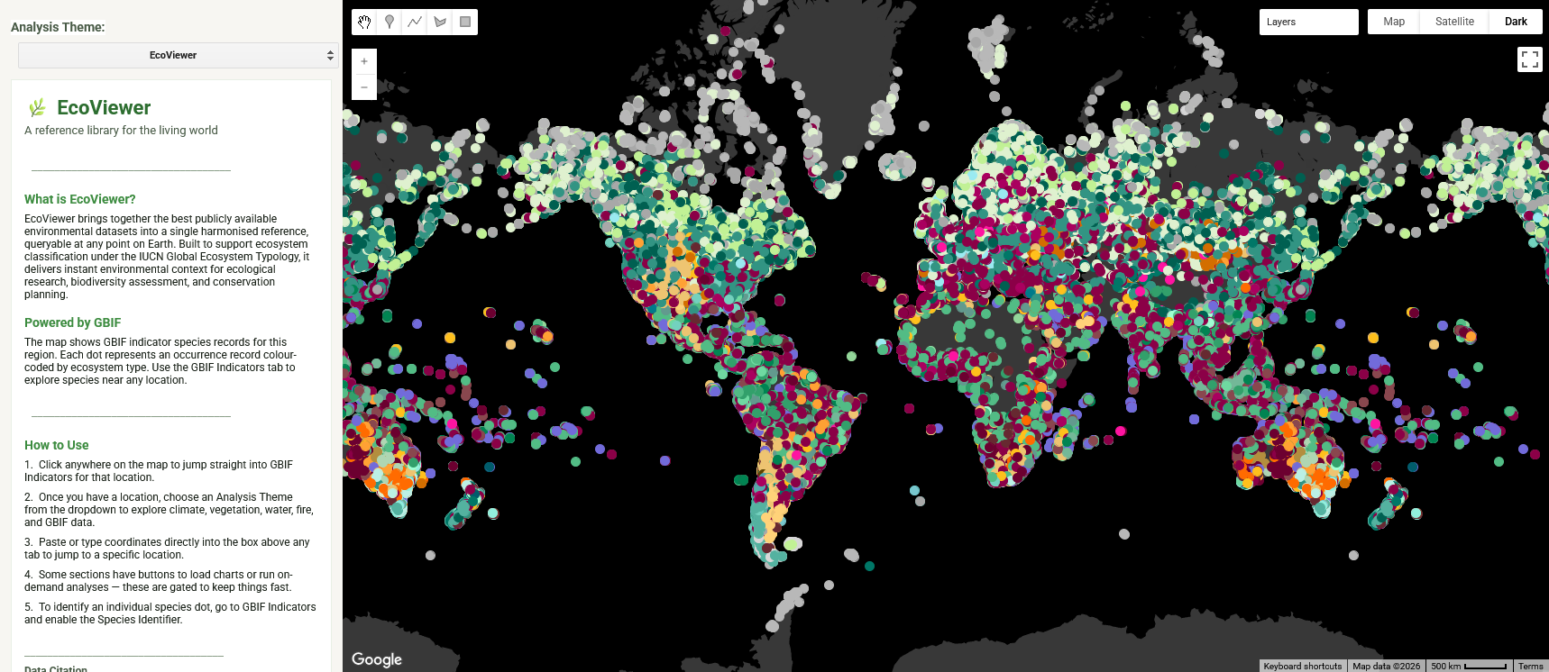
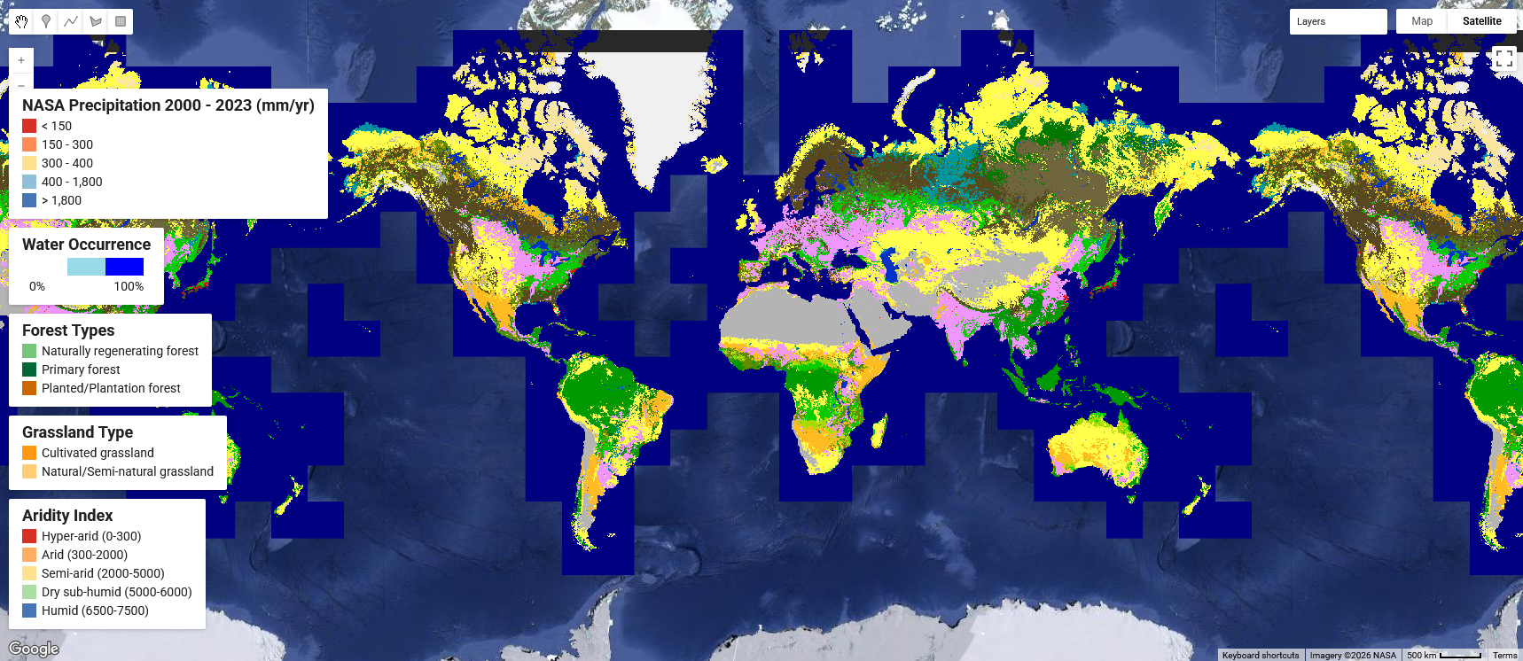
EcoViewer has changed significantly since its first prototype — and will continue to evolve. What started as a regional viewer for a specific geographic area has grown into a global, multi-source reference platform. New datasets, new regions, and new analytical capabilities are added as the science develops and the community around the tool grows.

EcoViewer — current version
EcoViewer — first prototype
After

Global platform · GBIF integration · Environmental layers

Before

Regional viewer · First prototype

What's inside
EcoViewer

Curious about the data behind EcoViewer? Explore the GBIF ecosystem indicator species methodology and pipeline, or dive into the global environmental layers — datasets, credits, licences, and the science behind every layer.